WHAT PILOTS ARE SAYING
Conversations
Pilot A
"Panomax is a daily tool, and has become a critical technology for our decision making. It is used for pre- and post-flight checks, essential to our operations. Before, we were reliant on only standard satellite information, that was updated every 30 minutes. This caused some operational issues.
However, with Panomax, we have the real visual data within 5 or 10 minutes. (depending on the camera model)".
Pilot B
"Frequent updates enhance awareness, enabling teams to respond effectively to visibility challenges during both day and night missions. As an example night time flight pre Panomax were almost non existent. Now we have roughly 400 night flights, only from our base, per year."
Pilot A
Operational Comparison: Pre-Panomax vs. Post-Panomax
Q1. What were the main challenges in your pre-flight checks before implementing Panomax, and how has the process changed with real-time visual data?
A: Before Panomax, pre-flight checks relied on outdated or generalized data from airports or automatic stations. Panomax now provides real-time visuals updated every 5-10 minutes, ensuring better-informed decisions and addressing gaps in situational awareness.
Q2. What tools did you rely on before Panomax for terrain and distance awareness, and how do Panomax’s overlay features now support your ability to navigate complex environments?
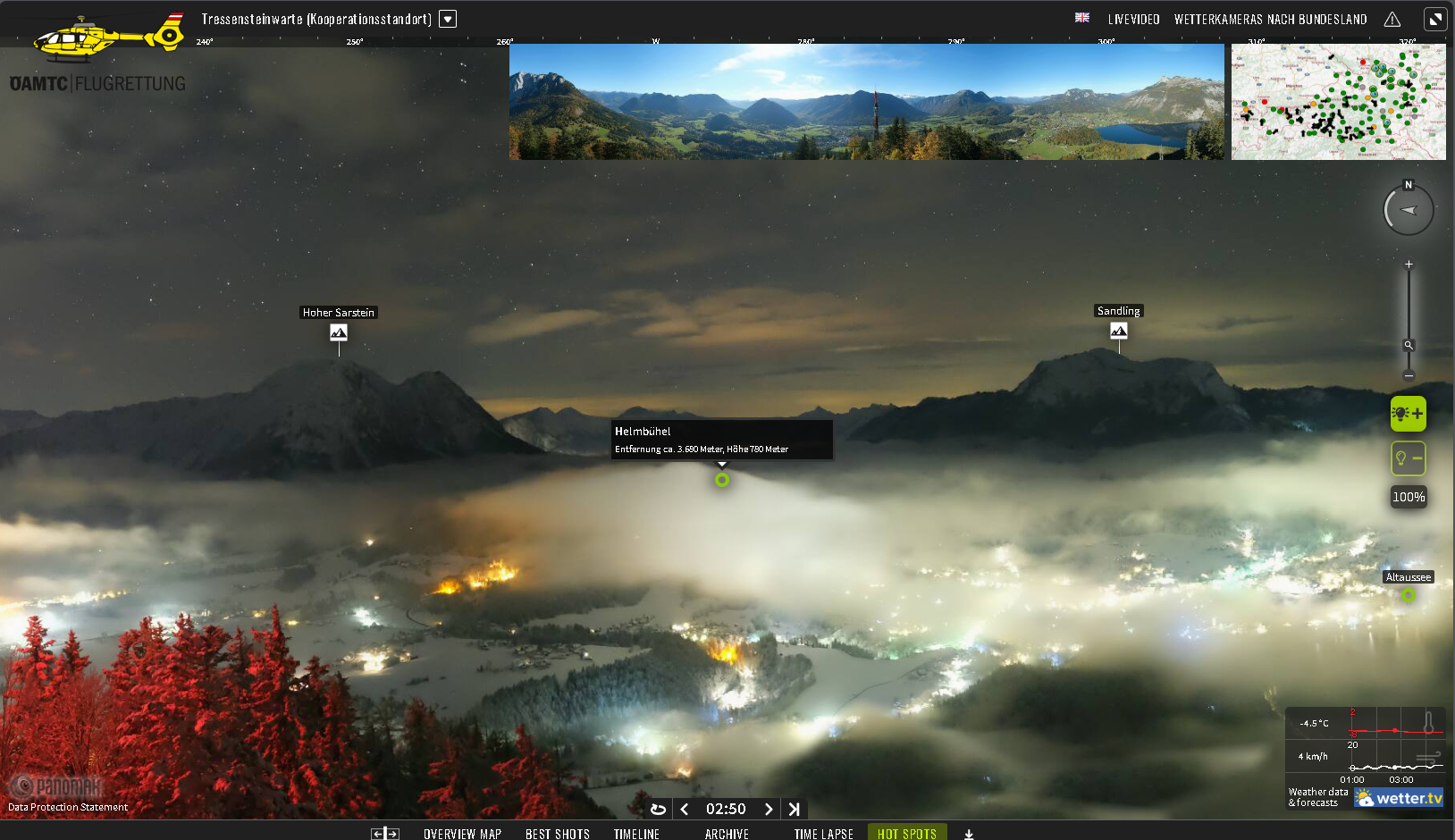
A: Before Panomax, night flights were limited, and navigation relied heavily on assumptions. Panomax overlays now enhance terrain awareness and allow safe, confident navigation at night.
Q3. Can you describe specific examples where real-time visual data from Panomax was essential for mission success or in avoiding potential hazards?
A: There have been many moments. I cannot pick a single moment. The camera gives our pilots a critical additional 2-3 minute window for decision-making, especially in areas where weather can rapidly change. Having these additional minutes assists us in having more successful missions.
Specific Improvements and Advantages Seen with Panomax
Q4. How has the availability of real-time, 24/7 visual data improved the accuracy and speed of your mission planning?
A: Real-time visual data allows quick decision-making, essential for 30-minute flights covering 100 km, helping pilots improve response times over short and long distances.
Q5. How does our technology assist in navigating challenging weather conditions, particularly in mountainous terrains like the Alps?
A: With one camera every 20 km, pilots get essential insights between zones, supporting safer navigation in mountainous areas and microclimate zones.
Q6. How have the interactive overlay features (indicating distances, heights, and structures) improved your ability to manage flight risks in low-visibility or complex environments?
A: Height and distance overlays are valuable, especially for new pilots, offering critical points of reference in complex environments.
Enhancing Situational Awareness and Mission Planning
Q7. How does the integration of Panomax technology with existing systems, like meteorological satellite information, enhance situational awareness for your team?
A: Real-time day/night images and 5 to 10-minute updates enhance situational awareness, providing critical data for preflight prep, especially when satellite data lacks adequate night visibility.
Q8. How has incorporating our technology into training programs improved the readiness and safety of your pilots and crew?
A: Technology integration has reduced response times significantly, improving stability and decreasing wrong flights or return flights to nearly 0%.
Training and Readiness for Pilots
Q9. Can you describe how our technology has become a key component of pre-flight checks or training scenarios?
A: Panomax is a daily tool, and has become a critical technology for our decision-making. It is used for pre- and post-flight checks, essential to our operations. Before, we were reliant on only standard satellite information that was updated every 30 minutes. This caused some operational issues. However, with Panomax, we have the real visual data within 5 or 10 minutes (depending on the camera model).
Regulatory Alignment and Future Needs
Q10. How do you foresee your operational needs evolving, and how could Panomax help you meet these changes, especially with evolving regulations?
A: Additional cameras will support approach aids in the future, especially when required by regulations.
Q11. How do you anticipate the upcoming EASA regulations affecting your operations, and how does Panomax help you proactively prepare for these requirements?
A: Panomax consolidates critical information in one place, a big advantage in meeting EASA's comprehensive requirements.
Pilot B
Operational Comparison: Pre-Panomax vs. Post-Panomax
Q1. What were the main challenges in your pre-flight checks before implementing Panomax, and how has the process changed with real-time visual data?
A: Prior to Panomax, pre-flight checks depended on outdated or generalized data from airports or automated stations. With Panomax, real-time visuals are now updated every 10 minutes, and soon every 5 minutes with the new cameras, providing more accurate information and significantly enhancing situational awareness for better decision-making.
Q2. How did limited visual data impact training for new pilots pre-Panomax, and what has changed in your training approach since integrating Panomax?
A: Training lacked real-time context, making it harder for pilots to prepare for complex situations. Panomax has become an integral training tool, improving readiness and confidence by offering real-time visuals for terrain navigation and microclimate assessment.
Q3. How did you assess microclimate zones or mountainous areas before Panomax, and how has the new technology impacted your navigation safety and efficiency in these regions?
A: Microclimates were previously difficult to detect, causing return flights in about 15% of missions. With Panomax, false flights have been reduced to less than 1%, significantly improving safety and operational efficiency.
Q4. What tools did you rely on before Panomax for terrain and distance awareness, and how do Panomax’s overlay features now support your ability to navigate complex environments?
A: Before Panomax, night flights were limited, and navigation relied heavily on assumptions. Panomax overlays now enhance terrain awareness and allow safe, confident navigation at night.
Specific Improvements and Advantages Seen with Panomax
Q5. What operational efficiencies have you experienced with Panomax that were previously difficult to achieve with traditional satellite or radar data?
A: Satellite and radar data were updated infrequently (e.g., every 30 minutes to an hour). Panomax’s frequent updates provide more accurate and timely information, eliminating delays caused by outdated data.
Q6. How has Panomax enhanced your situational awareness compared to pre-existing tools, particularly during missions that require rapid adaptation?
A: Situational awareness has improved dramatically, especially during night flights. Panomax enables confident decision-making even in low-visibility or rapidly changing conditions, increasing mission success rates.
Q7. What specific improvements have you noticed in flight safety when operating in low-visibility areas, now that Panomax provides real-time visual data?
A: Panomax’s visuals reduce reliance on assumptions and enable safer navigation. Night missions, previously infeasible, are now possible with confidence, enhancing overall safety.
From around 0 night flights to 400, at our base alone.
Q8. Can you describe a scenario where Panomax provided a critical advantage that may not have been possible without it?
A: Panomax has enabled flights in areas previously considered unsafe due to poor visibility. This technology has saved critical time, allowing missions to proceed where they would have otherwise been aborted.
Q9. In what ways has Panomax reduced instances of misdirected flights or unnecessary returns?
A: Return flights due to uncertain conditions have dropped from 15% to nearly 0%, at our base, showcasing the reliability of Panomax’s real-time data and visuals.
Q10. How many more flight completions are there now compared to before?
A: Flight completions have increased by approximately 15%, as Panomax enables alternative routes that were previously unavailable. This does not take into account the night flights.
Enhancing Situational Awareness and Mission Planning
Q11. How does the integration of real-time, day/night images and 5 to 10-minute updates improve situational awareness, especially during missions with visibility constraints?
A: Frequent updates enhance awareness, enabling teams to respond effectively to visibility challenges during both day and night missions. As an example night time flight pre 2017 were almost non existent. Now we have roughly 400 night flights, only from our base.
Q12. What role does Panomax’s night visibility play in pre-flight and in-flight planning, particularly for missions launched after dusk?
A: Night visibility has transformed planning by making night missions feasible and safe. This is particularly beneficial for hospital-to-hospital or outside-landing rescue missions.
Q13. How has Panomax influenced the decision-making process during rapid weather changes?
A: Decision-making is now faster and more accurate due to Panomax’s timely and localized data, reducing delays and increasing mission success rates.
Q14. How has real-time access to localized visuals supported safer navigation and more accurate predictions during flights?
A: Real-time visuals ensure safer navigation by eliminating reliance on generalized data. Predictions are more precise, reducing risks in challenging environments.
Training and Readiness for Pilots
Q15. How has incorporating Panomax into training programs impacted the readiness and confidence of new pilots?
A: Real data from Panomax has improved training effectiveness. Pilots are more confident and better prepared for real-world challenges.
Q16. What specific skills or efficiencies do you think Panomax has helped pilots develop through its real-time overlays and visuals?
A: Panomax enhances pilots’ ability to interpret terrain, weather patterns, and microclimates in real-time, improving decision-making and navigation skills.
Q17. How has Panomax enabled safer mission rehearsals in mountainous or difficult terrains?
A: Detailed visuals and overlays allow pilots to practice navigating complex terrains, boosting their readiness and safety during actual missions.
Q18. How has Panomax’s data consistency (compared to 30-minute satellite intervals) benefited pilots in time-sensitive training scenarios?
A: Frequent updates from Panomax provide more relevant and actionable data, making training scenarios more realistic and time-efficient.
Future
Q19 Would you recommend Panomax to other HEMS operations? If so, why?
A: Yes. Panomax offers high-quality visuals, reliable support, competitive pricing, and operational improvements unmatched by other technologies. It has significantly enhanced mission success rates, efficiency, and safety.
Panomax is trusted by HEMS operators in:
Austria, Germany, & Luxembourg.
While multiple partnerships are being built across the globe.
...Trusted across the globe...
