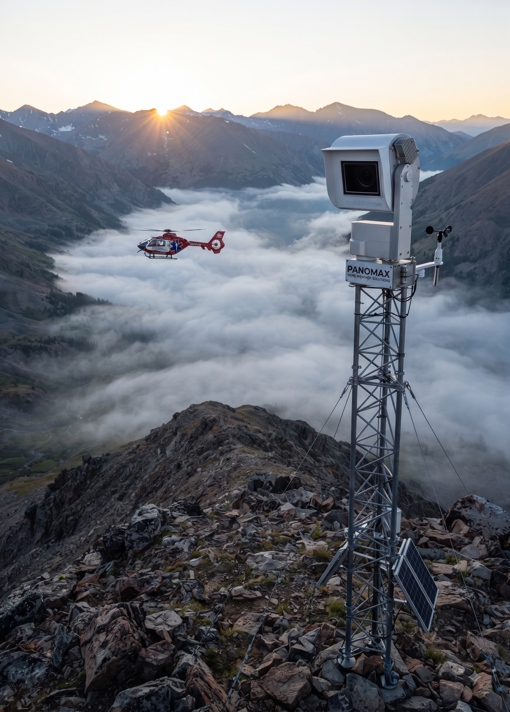


HEMS weather cameras provide live, location-specific visibility that forecasts alone cannot deliver. By showing real conditions at landing zones and along routes, Panomax cameras help helicopter emergency medical services assess weather faster, reduce uncertainty, improve dispatch decisions and support safer, more efficient operations across the US and Europe.
Why do weather forecasts create operational challenges for HEMS?
Weather forecasts are essential to every helicopter emergency medical service. However, they are forecasts—not live observations of the exact landing zone, route or hospital approach. Conditions can change quickly, particularly in mountainous, coastal or urban environments.
For HEMS pilots, that uncertainty can affect:
- Mission acceptance and dispatch decisions
- Route selection and fuel planning
- Landing-zone suitability
- Crew coordination and turnaround time
- The decision to continue, delay or abort a mission
A forecast may indicate acceptable conditions over a broad area while local fog, snow, low cloud, precipitation or strong winds affect one specific site. This gap between predicted conditions and what is happening on the ground can create avoidable operational pressure.
That is the challenge explored in Panomax’s new video. The video demonstrates how weather uncertainty affects real-world helicopter operations—and how visual, location-specific information can help teams make better-informed decisions.
What do HEMS weather cameras add to a forecast?
HEMS weather cameras add current visual context. Instead of relying only on a model or regional report, pilots and operational teams can view conditions at or near a relevant location before and during mission planning.
A live camera view can help reveal:
- Actual visibility and cloud movement
- Snow, rain, mist or fog at the site
- Surface conditions around a landing zone
- Daylight, darkness and changing illumination
- Weather trends that may not yet appear in a forecast
This does not replace approved aviation weather information, pilot judgement or operational procedures. It complements them with a practical view of the environment.
For chief pilots and HEMS programme directors, the value is not simply having another data source. It is having information that can be quickly understood and shared by the people responsible for making time-sensitive decisions.
How can Panomax cameras improve operational efficiency?
Operational efficiency often depends on reducing unnecessary uncertainty. When teams can verify local conditions earlier, they may spend less time trying to interpret conflicting reports or waiting for informal updates from people at a site.
Panomax’s interactive webcam technology supports a more connected workflow by making visual information available to authorised decision-makers. Depending on the operating environment, this can help teams:
- Check conditions before committing resources.
- Compare current visibility with forecast expectations.
- Coordinate pilots, dispatchers and ground personnel.
- Identify deteriorating conditions earlier.
- Record a clearer operational picture for post-mission review.
The result is not an automatic go/no-go decision. Rather, it gives qualified personnel better context for applying their procedures and experience.
Explore Panomax’s software solution to learn more about how interactive camera technology can support weather monitoring and operational coordination.
Why is real-time visual information important for safety?
Safety decisions are stronger when they are based on relevant, current and location-specific information. A broad forecast can describe a region, but a camera can show what is happening at a particular landing zone or observation point.
For HEMS organisations, that additional perspective may support safer choices in situations involving rapidly changing weather. It can help crews recognise when conditions differ from expectations and encourage earlier, more deliberate decisions rather than last-minute reactions.
The safety benefit also extends beyond the cockpit. Dispatch teams, programme leaders and partner organisations can work from the same visual reference, improving shared situational awareness. This is especially valuable when several locations, crews or agencies are involved in a mission.
Panomax cameras are designed to meet the requirements set out in AMC1 SPA.HEMS.145(b) and AMC1 CAT.OP.MPA.192. Organisations should always assess technology within their own approved procedures, regulatory responsibilities and risk-management framework. Visit the Laws & Regulations page for more information about the regulatory context.
How are HEMS weather cameras being used across the US and Europe?
HEMS operations in the US and Europe face different geography, infrastructure and regulatory environments. Yet the central challenge is similar: teams need dependable information about conditions at critical locations.
In Europe, mountainous terrain, narrow valleys and rapidly changing alpine weather can make regional forecasts difficult to apply to one landing zone. In the US, long distances, remote bases and varied local conditions can create comparable information gaps.
Interactive cameras can support a range of use cases, including:
- Monitoring remote or difficult-to-access landing zones
- Supporting weather awareness around HEMS bases
- Assessing conditions near hospitals and operational sites
- Providing shared visibility for dispatch and coordination teams
- Reviewing changes in weather during an extended response
The right deployment depends on the organisation’s mission profile, locations and procedures. Panomax works with organisations seeking HEMS solutions that combine practical visibility with a clear operational purpose.

What should HEMS leaders consider before deploying camera technology?
Technology is most useful when it fits the way an organisation already works. Before selecting a camera solution, HEMS leaders should consider:
- Which landing zones or routes create the greatest weather uncertainty?
- Who needs access to live and historical visual information?
- How will camera data complement existing forecasts and reports?
- What connectivity, maintenance and resilience requirements apply?
- How will the solution fit approved procedures and governance?
It is also important to consider image quality, coverage, accessibility and the ability to communicate information quickly. A camera should provide operational value—not simply generate more data.
Panomax offers services for organisations evaluating 180- and 360-degree interactive webcam solutions for helicopter weather monitoring and related applications.
Watch the new Panomax video
The new video brings the challenge to life: forecasts can provide a valuable regional picture, but operational teams also need to understand what is happening at the exact location that matters.
Watch it to see how Panomax cameras can help close that information gap, support faster assessment and improve operational efficiency without replacing professional judgement or established aviation procedures.
If your organisation is reviewing weather-monitoring capabilities, the video is a useful starting point for discussion with pilots, dispatch teams, safety managers and executive stakeholders. You can also contact Panomax to discuss your operational requirements.
Key takeaways
- Forecasts remain essential, but they may not show conditions at a specific landing zone.
- HEMS weather cameras provide live visual context for better-informed decisions.
- Panomax technology can support efficiency, coordination and situational awareness.
- Camera information should complement—not replace—approved weather data and pilot judgement.
- The next step is to identify where local visibility could improve your operational process.
HEMS weather cameras are most valuable when changing conditions, remote locations or limited visibility create uncertainty. By combining forecasts with live local imagery, pilots and programme leaders can build a clearer operational picture before acting. Panomax’s new video shows why that distinction matters across the US and Europe. Watch it, identify the locations where weather decisions are hardest, and evaluate whether interactive camera coverage could strengthen your organisation’s safety and efficiency framework.